Colorado River Salinity Control Program
What is the Colorado River Salinity Program?
The Colorado River salinity control program is a multi-state effort to reduce the amount of salt in the Colorado River. The river carries millions of tons of salt downstream each year. This enormous amount of salt causes hundreds of millions of dollars of damage to human activities and to the natural environment. Part of the salt carried by the river comes from natural sources, and part comes from human activities, with activities related to irrigation being the largest human activity.
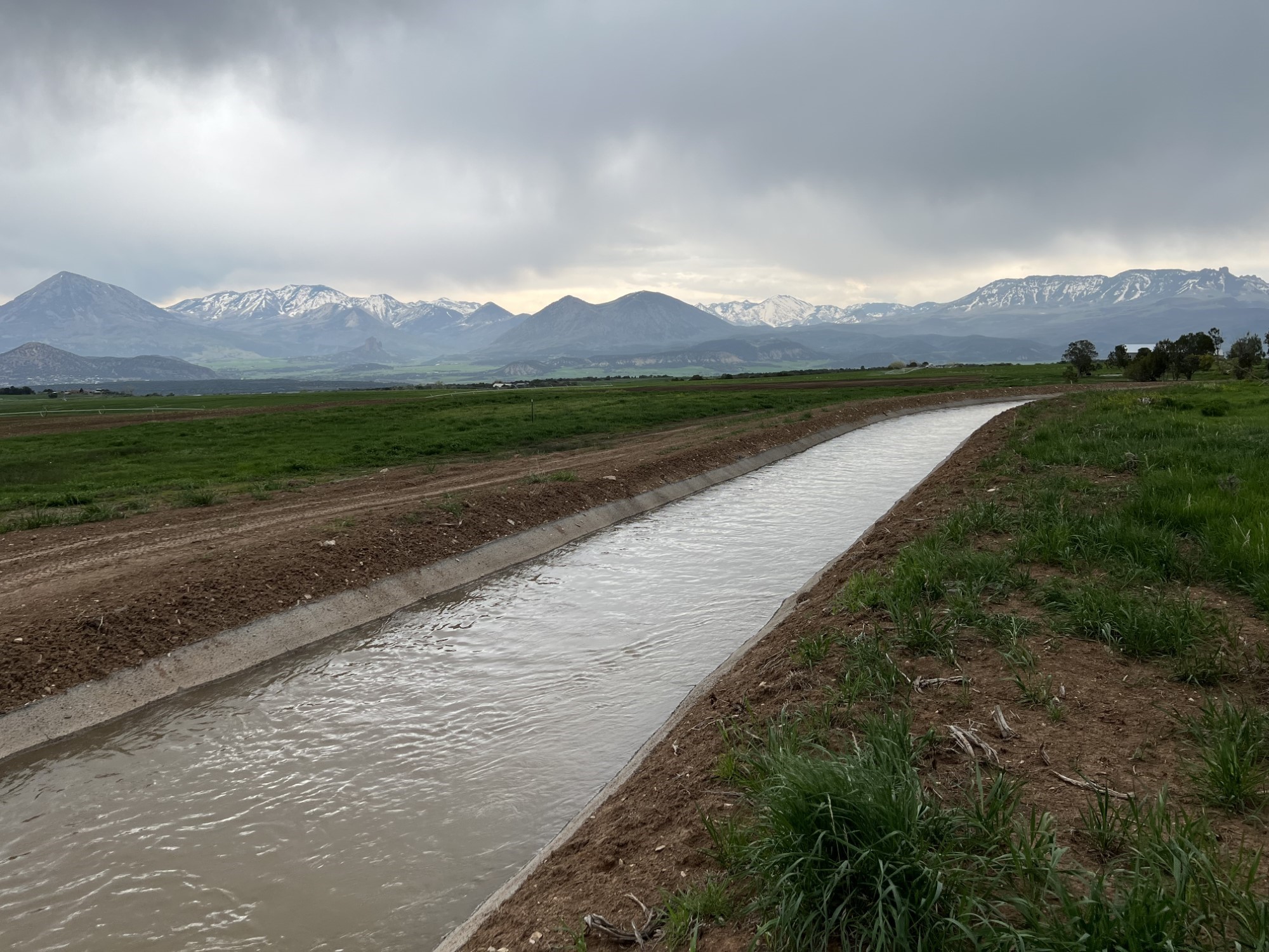
Installing pipe to prevent water from picking up salt from the soil
Funding Available
Funding is available from the Bureau of Reclamation and the Natural Resources Conservation Service (NRCS) to install water delivery systems and irrigation systems that reduce the amount of salt in the river caused by irrigation. Typical projects include lining and piping of ditches and installation of more efficient on-farm irrigation systems such as gated pipe and sprinkler irrigation. The funding assistance ranges from less than 50% to 100% of the cost of the project, depending on the specifics involved.
Who is eligible for funding?
All water users in Colorado who are in the Colorado River basin are eligible for funding. However, the great majority of funding goes to ditch companies and farmers in designated salinity control areas.
These areas are:
- Silt Salinity Control Area (SCA): A portion of the irrigated land along the north side of the Colorado River between Silt and Rifle;
- Debeque SCA: A portion of the irrigated land near the town of De Beque;
- Grand Valley SCA: Most of the irrigated land in the Grand Valley between Palisade and the Utah state line;
- Whitewater SCA: A portion of the Irrigated land on the lowland mesas and stream valleys of Whitewater, Kannah, and Callow Creeks near the town of Whitewater;
- Lower Gunnison SCA: Most of the irrigated land in the Gunnison Valley below Morrow Point Dam and most of the irrigated land in the Uncompahgre Valley from the Ridgway area and downriver;
- Manco SCA: Most of the irrigated lands within the Mancos River Basin near the town of Mancos; and
- McElmo SCA: Most of the irrigated land in the McElmo Creek and Navajo Wash basins in southwestern Colorado.
Water users who are not in the salinity control areas may contact the Bureau of Reclamation and the NRCS (see below) to discuss possible opportunities to participate in the salinity control program.
Before salinity control work
After salinity control work
Additional information about the salinity control program is available at:
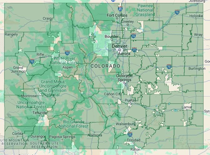
Conservation Districts within the salinity control areas.
Click on this map to go to the Colorado State Conservation Board webpage. Scroll down and expand the map to find your district and click on the district. The conservation district contact information will appear on the left.
For more information and help with applying for funding
The Colorado Department of Agriculture’s Salinity Program Coordinator is available to assist those who wish to know more about the program or are interested in applying for funding:
Paul Kehmeier
paul.kehmeier@state.co.us
720 614-4921